Posts

Showing posts from July, 2020

Syria After Dark

Image
Satellite images of Syria taken at night capture a subtle trace left by human civilization: lights. Apartment buildings, street lights, highways, powerplants-- all are illuminated at night and can be seen from space. Researchers often use these nighttime lights signatures to track development; as cities grow, villages recieve power, and infrastructure is built, areas emit more light. But this works both ways. As cities are demolished, villages burned, and highways cutoff, they stop emitting lights.  The timelapse below uses imagery from the Defense Meteorological Satellite Program (DMSP), a joint program run by the U.S. Department of Defense and the National Oceanographic and Atmospheric Agency.  One image is taken per year between 2005 and 2013: Some striking trends are visible. Night-time lights increase steadily between 2005 and 2008, a pattern that accelerates between 2
Hasankeyf's Last Vote

Image
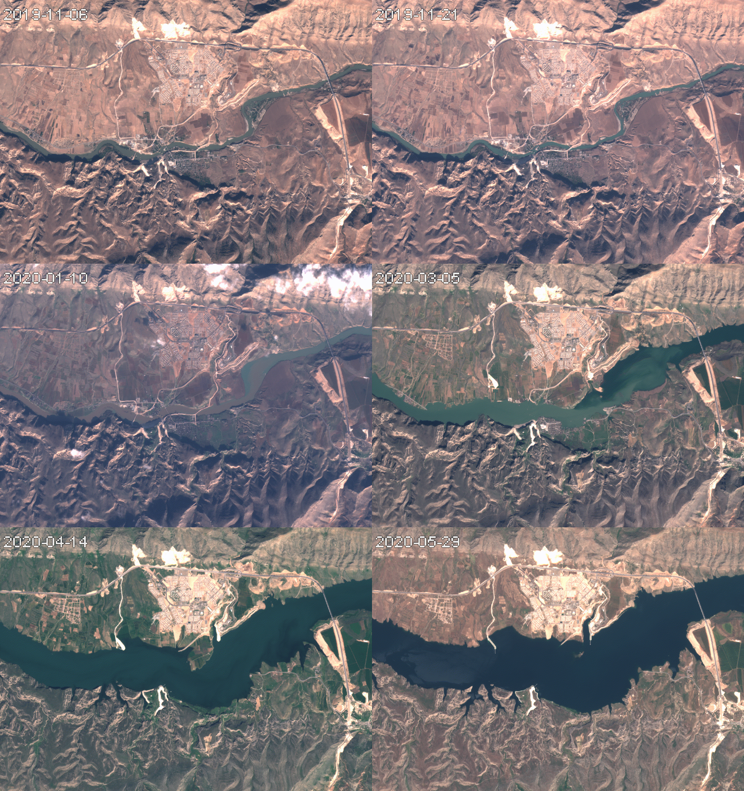
       The Turkish city of Hasankeyf was first inhabited at least 7,000 years before the humans developed written language. Earlier this year,  as Erdoğan fulfilled his 2008 vow to complete the Ilisu Dam,  it was flooded by the waters of the Tigris river.           In the timelapse below,  Hasankeyf can be seen nestled between the mountains to the south and the Tigris river. The sprawling development to the north is Yeni Hasankeyf (New Hasankeyf), a town built to resettle inhabitants of the flooded city.  Multispectral timelapse (Sentinel-2)         The fact that development megaprojects create winners and losers is not new. Nor is the notion that the "winners" might electorally reward their political patrons; o ne might expect a village that received electricity from the dam, or a farming community that received irrigation water from