Posts

Showing posts with the label JavaScript

Hasankeyf's Last Vote
Image
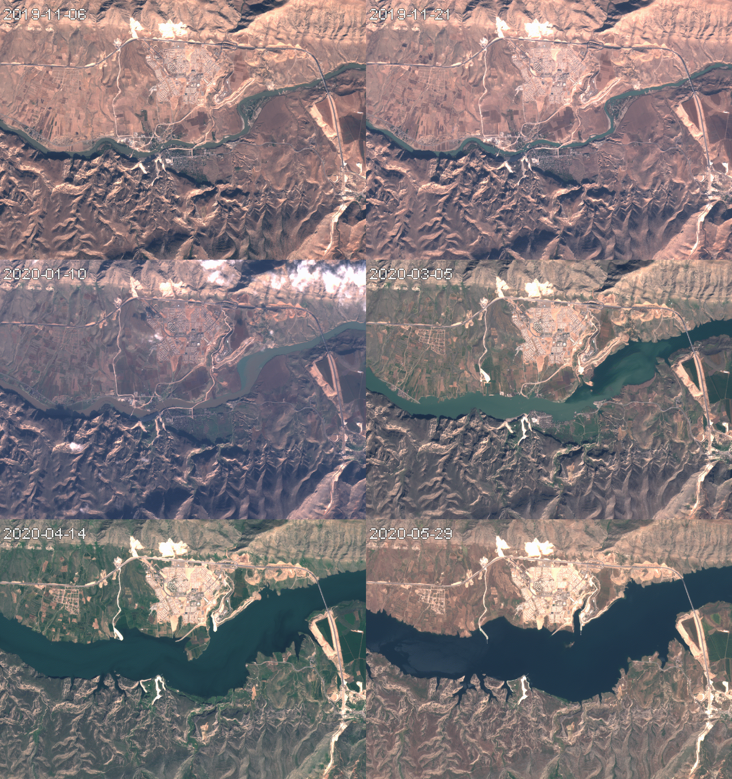
       The Turkish city of Hasankeyf was first inhabited at least 7,000 years before the humans developed written language. Earlier this year,  as Erdoğan fulfilled his 2008 vow to complete the Ilisu Dam,  it was flooded by the waters of the Tigris river.           In the timelapse below,  Hasankeyf can be seen nestled between the mountains to the south and the Tigris river. The sprawling development to the north is Yeni Hasankeyf (New Hasankeyf), a town built to resettle inhabitants of the flooded city.  Multispectral timelapse (Sentinel-2)         The fact that development megaprojects create winners and losers is not new. Nor is the notion that the "winners" might electorally reward their political patrons; o ne might expect a village that received e...

Calculating High-Resolution Standardized Precipitation-Evapotranspiration Index

Image
This post outlines a workflow for the calculation of a high-resolution version of the Stardardized Precipitation-Evapotranspiration Index (SPEI). This is accomplished in four steps, utilizing Python, R, and JavaScript. Quantifying the precise onset, duration, and end of droughts is difficult. Most approaches have historically measured drought as a prolonged deviation from the mean rainfall in an area. The Standardized Precipitation-Evapotranspiration Index (SPEI) builds on previous approaches by incorporating temperature data to account for the amount of water lost to evaporation. This is important because in an arid climate, a six week shortage in rainfall during the summer would have a much greater impact on soil moisture than the same shortage during the winter. This is especially important for drought forecasting that accounts for anthropogenic climate change. Indices that do not incorporate temperature data will persistently underestimate drought incidence as global t...